Mount Si and Little Mount Si were formed millions of years ago by an upthrust along a fault line. The Mountains got their name from an early settler named Josiah (Uncle Si) Merritt. He lived at the western base of the mountains near the site of present day North Bend, WA. Supposedly Mount Si was never logged, but in 1910 a fire engulfed the whole mountain. The growth on the mountain today is a result of that burn in the early 1900’s.

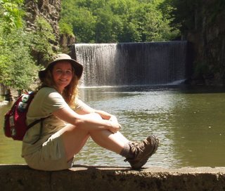
When I got to the parking lot at Little Mount Si yesterday morning, it was already full. There were only 2 spots left and I took one of them. There were two vans, which should have warned me that the trail would be crowded with kids! I have never seen the trail so busy and especially on a week day! But it was a gorgeous sunny day in Seattle with highs in the 70’s and everyone was taking advantage of the weather.
Today, the weather was still cool, but cloudy. I drove down to Enumclaw to tackle Mount Peak. I have always known this little mountain as Mount Peak, but it has a bunch of different names. Mount Pete and Pinnacle Peak are two of them. It is also the site of the Cal Magnusson Trail. Supposedly the mountain was called Mount Pete, for a Yugoslav named Pete Chorak who emigrated to Enumclaw, WA in 1911 and donated the land for the park. The trail to the top was named for Cal Magnusson, a local Boeing Employee, who had hiked and maintained the trail for the past several decades. I don’t know why it is called Mount Peak or Pinnacle Peak!
Mount Peak is a volcanic knob that was encased by the later deposits of the Osceola Mudflow. The Osceola Mudflow was when part of Mount Rainier sloughed off about 5,600 years ago and sent a slurry of rock and glacier into the river valleys. Mount Peak tops out at 1800 feet and used to have a Forest Service Fire Lookout at the top. It is long gone and all that is left is the evidence of the foundations.
Unlike Little Mount Si the day before, Mount Peak was practically deserted. There were only
 two other cars at the trailhead and I passed their owners as they were making their way down the hill. Mount Peak is a 2 mile hike, mostly straight uphill, but it is over quickly! It was cloudy today and there were only peek-a-boo views through the trees along the climb to the top.
All my mountain climbing resulted in 7 more miles for the hike-a-thon. For a total of 16 miles!