 |
| On the PCT at Hart's Pass |
First up was pretty exciting because I drove Ryan up to Hart's Pass so he could take the PCT back to the Pacific NORTHWEST trail, so that he could continue his Thru-hike, which has now become a section hike of the Pacific Northwest Trail (Or PNT) He will hike about 13 or so miles from Hart's Pass to connect again and continue his quest to reach the Pacific Ocean.
So I got in a lot of hiking for 2 days in the North Cascades. And figured out that I was severely out of shape!! LOL The trails were not in horrible shape, but the fact that many WTA work parties have been cancelled because of Covid has taken it's toll. Please think about donating to help You can click on this link to go to my WTA fundraiser page
https://give.wta.org/fundraiser/2808889
 |
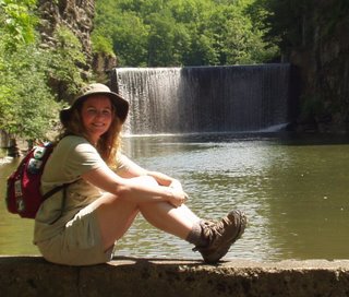
| A wide spot in the road coming down from Hart's Pass |
And did I mention the scary scary drive up to Hart's Pass on Forest Service Road 5400. It is the highest point in the state of Washington that you can drive to!! over 6000 feet in elevation. (I think you top out at about 7100 near Slate Peak) The road was built in 1893 for access to gold and silver mines in the area. The narrow road hangs along a cliff wall and is pretty much a single lane for 9-10 miles. So if you meet a car, someone has to back up to a wide spot in the road. The road is maintained for low clearance vehicles like the family car
Part of the history of the road is that in the 1890's a string of pack horses were loaded with supplies and heading up to Hart's Pass and one of the last horses pulled back, not wanting to continue, since all the horses were tied together, the other horses lost their footing and the whole string went over the edge. This narrow stretch of the road is called Dead Horse Point and is the worst part of the drive to this day.
Ryan was with me on the uphill drive, but the next day I had to drive down alone. I was gripping that steering wheel, white-knuckled the entire way. I still have a cramp in my hand.
One of my hikes was on the East Creek Trail and a bridge washed out derailed that hike. another example of why we need the Washington Trails Association to help do maintenance on these trails.
 |
| Bridge Out |
Thanks to
for their donations!
Please consider making a donation to my WTA hike-a-thon. Any amount from $1 to $100 is welcome.
You can click on this link to go to my WTA fundraiser page
https://give.wta.org/fundraiser/2808889
or you can send me a check (made out to WTA (Washington Trails Association) or just a dollar in the mail would be very welcome.
You can click on this link to go to my WTA fundraiser page
https://give.wta.org/fundraiser/2808889
or you can send me a check (made out to WTA (Washington Trails Association) or just a dollar in the mail would be very welcome.
to: Amanda Arkebauer PO Box 16131 Seattle, WA 98116


1 comment:
Well this is embarrassing, I had this post set to publish and I was waiting til the last minute to be able to thank my sponsors and no one contributed this week. Very sad really. So ithar is why there are no names in my Thank You up above. Please think about donating next week. We do appreciate it.
Post a Comment